AngularJS directive for visualising data on interactive 3D globe.
- AngularJS
- D3.js
- topojson (only if using version with built in map)
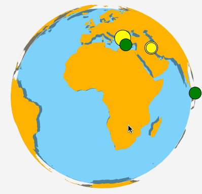
You can see it in action here madvas.github.io/angular-globe
$ bower install angular-globe --saveThis will download two kinds of files:
- angular-globe.js - Needs to load land data manually. See Expert Example
- angular-globe-with-map.js - Version with built in land data for convenient usage
angular.module('myModule', ['madvas.angular-globe'])<m2s-globe
points="points"
point-lat="d.position.lat"
point-lng="d.position.lng"
point-radius="d.pointRadius"
point-fill="d.fillColor"
draggable="true"
clickable="false"
point-stroke-width="1">
</m2s-globe>For more explanatory examples see: madvas.github.io/angular-globe
Would be great ;)